By Kadijatu Bangura D.S. Reporter
Freetown
The National Protected Areas Authority has launched the second phase of its GIS mapping exercise aimed at identifying buildings and developments earmarked for removal within Sierra Leone’s protected areas.
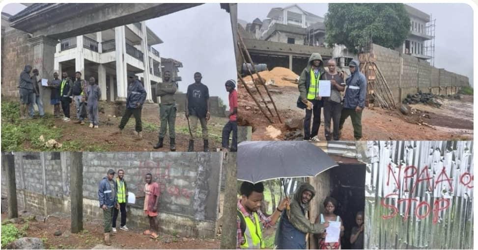
The operation, led by NPAA’s Geographic Information System Unit, is currently underway along the corridor from the Tacugama Chimpanzee Sanctuary to Brandon-Height.
According to the Authority, the exercise involves detailed verification of all structures found within protected area boundaries and designated demolition zones. Teams on the ground are combining GPS field surveys with high-resolution satellite imagery and GIS technology to capture precise spatial data.
NPAA said the data will form the basis for evidence-based enforcement actions and will strengthen conservation planning and environmental management across the country’s reserves.
“The goal is to ensure our mapping is accurate, transparent and technically credible,” an NPAA official stated. “This will guide government decisions on which structures contravene protected area regulations.”
The Authority noted that the initiative is part of its broader commitment to curb encroachment and safeguard critical habitats and biodiversity in Sierra Leone.
Upon completion, NPAA will submit detailed GIS maps and technical reports to inform the next phase of the intervention.
For more information contact Daily Scope Newspaper at dailyscopemedia@gmail.com