By Saidu Jalloh, D.S.
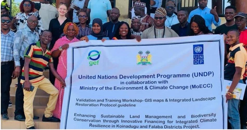
The Ministry of the Environment and Climate Change, in collaboration with the United Nations Development Programme, has validated a new set of Geographic Information System maps set to transform sustainable land management and biodiversity protection in Koinadugu and Falaba districts.
The maps were endorsed during a two-day Validation and Training Workshop on GIS mapping and Integrated Landscape Management and Biodiversity Conservation, held June 17–18, 2026, at the Koinadugu District Council Hall in Kabala.
Organizers said the workshop’s primary objective was to review and validate draft GIS maps and integrated landscape management protocols developed under the UNDP-funded initiative. The exercise aimed to verify technical accuracy, secure local ownership, and equip stakeholders for effective rollout on the ground.
The workshop forms part of the project “Enhancing Sustainable Land Management and Biodiversity Conservation through Innovative Financing for Koinadugu and Falaba Districts.”
Participants included officials from the Ministry of Agriculture and Food Security, UNDP Sierra Leone’s technical team and Project Management Unit, the Environmental Protection Agency, Tacugama Chimpanzee Sanctuary, the Conservation Society of Sierra Leone, alongside Paramount Chiefs, Senior Section Chiefs, and Ward Councillors.
The validated GIS tools will strengthen data-driven planning, monitoring, and decision-making for land use, forest protection, and biodiversity conservation across the two districts.
For more information contact Daily Scope Newspaper at dailyscopemedia@gmail.com